


Dr. Hugh Cutcher
June 4, 2025
Share this post
A low-pressure system locked in over central North America shaped May’s solar climate across the continent, drawing cloud and rain over the East while leaving the West under the influence of stabilizing high pressure. This division suppressed irradiance on the East Coast and supported moderate gains in the West and Midwest, setting up a geographically split solar performance profile.

Throughout May, a persistent low-pressure trough anchored over Canada and the central U.S. funneled storm systems across the eastern seaboard. As a result, solar irradiance plummeted across key regions. From New York to Maine, irradiance was up to 30% below the long-term average for this time of year. Quebec and large swathes of the Southern U.S. also recorded deficits of around 20%. The impact of these conditions was compounded by intense rainfall; in mid-May, a particularly slow-moving storm system led to flash flooding and regional alerts, further disrupting solar potential.
In contrast, the western half of the continent was under the influence of a dominant high-pressure system that brought cool and dry conditions. These stable atmospheric conditions helped maintain slightly above-average irradiance levels across much of the U.S. West and most of Canada. This continuation of a March-established pattern brought consistency in solar availability, although temperatures remained below normal and drought persisted, particularly in the Rocky Mountains.
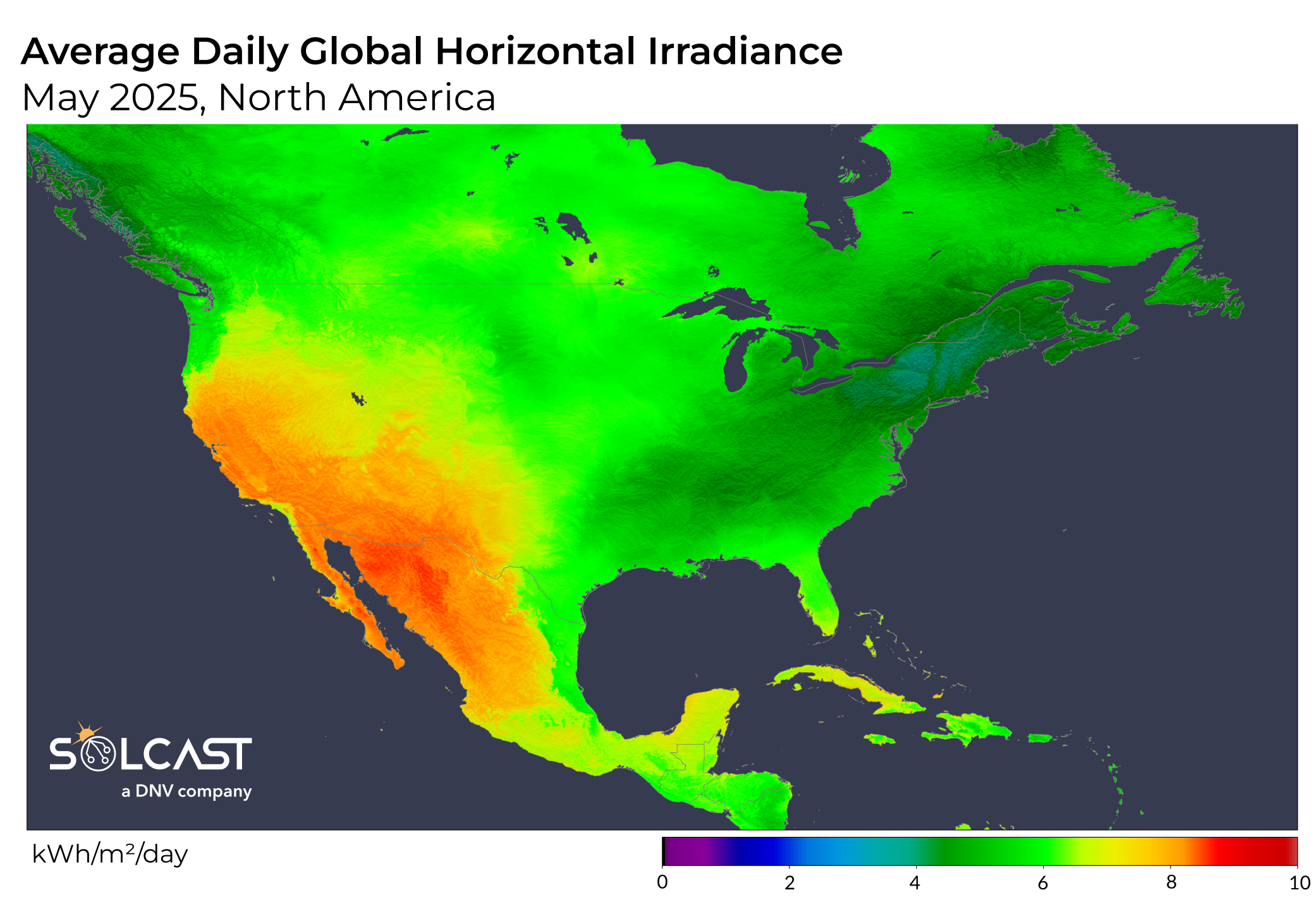
The Midwest emerged as May's standout region for solar conditions. While convective storm activity delivered much-needed rainfall that eased some drought concerns, skies remained clear enough to support strong irradiance. Most of the region saw irradiance levels around 10% above average, with peak values reaching up to 30% above normal from Minnesota to central Canada. However, this same dry heat led to significant wildfire activity in Manitoba, with smoke tracked as far as Europe, as previously reported.
Further south, high pressure also shaped Mexico's May weather, diverting Pacific moisture offshore and preventing significant rainfall. The result was a hotter-than-average and drier month, especially in southern regions. Solar irradiance responded accordingly, with values above average in the south and near-normal elsewhere across the country.
Track weather conditions, cloud movements, and irradiance-influencing factors that might impact your solar generation. Access bankable actuals and accurate forecasts when you sign up for a Solcast API toolkit. You can reach out to our team for an extended trial.