


Dr. Hugh Cutcher
June 11, 2025
Share this post
In a similar pattern to recent years, a persistent high-pressure system over southern Australia has diverted the usual cloud-bearing southerly fronts. Instead, moisture from the Coral Sea has been drawn deep into eastern Australia, driving a clear contrast in irradiance across the country. This pattern suppressed cloud formation and rainfall in the south and west, while funneling humid, rain-bearing air inland through the north and east.
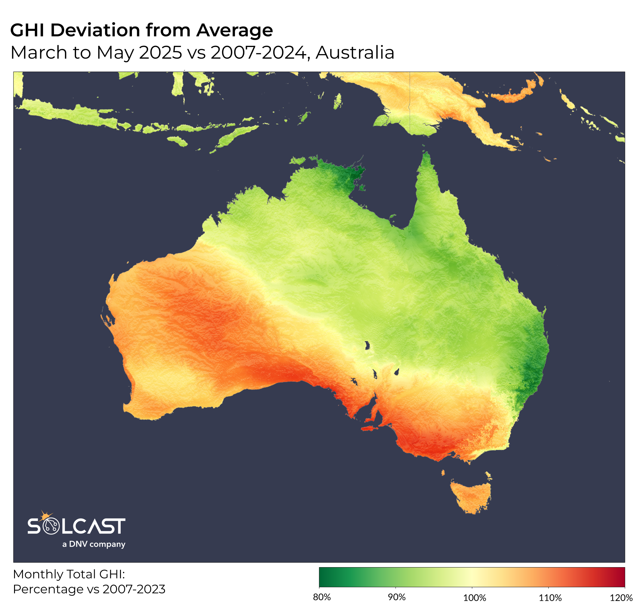
Throughout autumn, an unusually stationary high-pressure system straddling South Australia and the Tasman Sea redirected weather systems away while reinforcing onshore winds from the Coral Sea. This setup brought moist air inland, leading to more persistent cloud formation and rainfall. The result was a markedly cloudier season for Queensland, New South Wales (NSW), and the Northern Territory. Instead of the frontal systems and cooler southerlies typical of the period, much of the east contended with extreme rain events and subdued solar irradiance. The impact was sharp: irradiance across large portions of the east fell by up to 20% below the seasonal norm.
Early autumn rainfall in Queensland was still being influenced by the lingering moisture of Ex-Tropical Cyclone Alfred, with daily totals surpassing 100mm. Later in the season, Bellingen in northern NSW recorded more than 300mm in a single May event. These large, concentrated rain events feel all too frequent for those impacted by flooding, and are a significant change from the typical pattern of smaller, lower-intensity rain fronts.
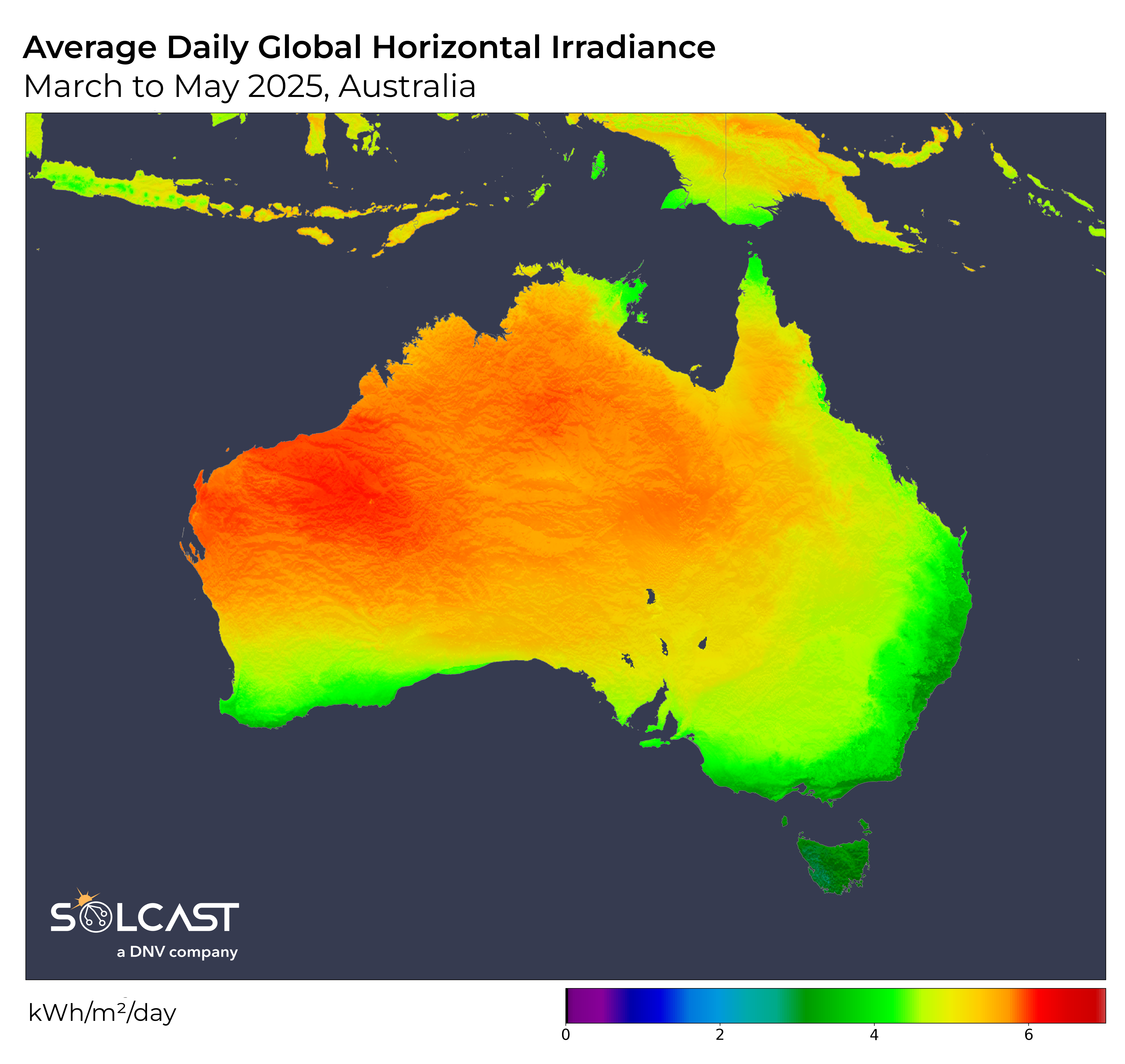
In stark contrast, the same high pressure system that brought cloudier than usual conditions in the east, suppressed it in the west and south. Stretching from Western Australia through Southern Australia, Victoria, and western NSW, the high pressure blocked rain-bearing cold fronts and inhibited convective activity, creating extended dry, clear weather.
These conditions drove irradiance levels as much as 20% above seasonal averages across much of Western and Southern Australia. The stability of the air mass also allowed for the buildup of strong westerly winds, which, combined with parched surface conditions, generated a significant dust storm in May that originated in South Australia and swept through the Illawarra and Sydney basins.
Track weather conditions, cloud movements, and irradiance-influencing factors that might impact your solar generation. Access bankable actuals and accurate forecasts when you sign up for a Solcast API toolkit. You can reach out to our team for an extended trial.